

Master Modern Spatial Analysis and Geospatial Technology
Ferford Capacity Developers Africa’s GIS and Remote Sensing training equips professionals, researchers, and policymakers across Africa with the spatial analysis skills essential for modern decision-making. Covering over 265 specialised programmes, the curriculum spans foundational cartography and data collection through to advanced applications in GeoAI, machine learning, drone surveying, and predictive spatial modelling.
Courses provide hands-on experience with industry-standard software — QGIS, ArcGIS, ERDAS IMAGINE, Google Earth Engine, and Python — through scenario-based exercises and real-world case studies. The focus throughout is translating theoretical knowledge into precise, reliable geospatial outputs: mitigating common data interpretation errors, improving spatial data quality, and applying analytical techniques that produce accurate, reproducible results.
Key thematic areas include climate resilience and adaptation planning, sustainable urban development, natural resource management, disaster risk reduction, public health epidemiology, and precision agriculture — helping participants address both continent-wide and localised challenges with data-driven insight. Training can also be tailored to specific organisational or sectoral needs, from urban planning to climate resilience to precision agriculture.
Training Delivered Across Africa
Delivered with a strong presence across the continent, courses use region-specific case studies and applications — from monitoring desert locust outbreaks in the Horn of Africa and mapping blue carbon ecosystems along coastal nations, to analysing urban heat islands in growing cities and optimising renewable energy site selection.
- West Africa — The Gambia, Ghana, Liberia, Nigeria, Sierra Leone
- East Africa — Kenya, Rwanda, Tanzania, Uganda
- Southern Africa — Botswana, Eswatini, Lesotho, Malawi, Mauritius, Namibia, South Africa, Zambia, Zimbabwe
- Central & North Africa — Cameroon, Eritrea, Sudan, South Sudan, Ethiopia
| Course Code | Course Title |
|---|---|
| 001 | Advanced Geospatial Machine Learning and AI for Remote Sensing |
| 002 | Advanced GIS and Remote Sensing for Sustainable Urban Planning |
| 003 | Advanced GIS for Land Use Conflict and Environmental Justice Studies |
| 004 | Advanced GIS for Transportation and Mobility Planning |
| 005 | Advanced Remote Sensing for Soil Health, Crop Monitoring, and Food Systems Resilience |
| 006 | Advanced Spatial Data Integration: GIS, IoT, and Sensor Networks |
| 007 | Advanced Spatial Data Interpolation and Modelling with GIS |
| 008 | Advanced Spatial Data Visualization with GIS |
| 009 | Advanced Spatial Modelling and Predictive Analytics in GIS |
| 010 | Climate Resilience and Adaptation Planning using GIS and Remote Sensing |
| 011 | Climate-Induced Migration and Displacement Mapping using GIS and Remote Sensing |
| 012 | Disaster Preparedness, Crisis Response, and Recovery Mapping |
| 013 | Drone Mapping, Modelling and Surveying Program |
| 014 | Earth Observation and GIS for Sustainable Urban Finance and Green Bonds |
| 015 | Earth Observation for Monitoring Global Biodiversity Framework Targets |
| 016 | Empowering Communities through Participatory GIS and Risk Mapping |
| 017 | Geographic Information Systems (GIS) and Spatial Data Analysis with IT Tools |
| 018 | Geographic Information Systems (GIS) with Remote Sensing Integration |
| 019 | Geospatial Approaches to Urban Flood Risk and Drainage Systems |
| 020 | Geospatial Artificial Intelligence (GeoAI) in Remote Sensing Applications |
| 021 | Geospatial Big Data Analytics for Decision-Making |
| 022 | Geospatial Blockchain Applications for Land Tenure and Property Registries |
| 023 | Geospatial Intelligence in Urban Security and Policing |
| 024 | GIS Analysis in Water Sanitation and Hygiene (WASH) |
| 025 | GIS and Data Analysis for WASH (Water Sanitation and Hygiene) Programmes |
| 026 | GIS and Remote Sensing Applications in Water Resources Management |
| 027 | GIS and Remote Sensing Disease Surveillance Monitoring |
| 028 | GIS and Remote Sensing for Agricultural Resource Management |
| 029 | GIS and Remote Sensing for Electric Mobility and Charging Infrastructure Planning |
| 030 | GIS and Remote Sensing for Migration, Refugees, and Human Displacement Studies |
| 031 | GIS and Remote Sensing for Monitoring Illegal Mining and Deforestation |
| 032 | GIS and Remote Sensing for Monitoring Offshore Renewable Energy Wind and Tidal |
| 033 | GIS and Remote Sensing for Peacebuilding and Post-Conflict Recovery |
| 034 | GIS and Remote Sensing for Public Health and Epidemiology |
| 035 | GIS and Remote Sensing for Renewable Energy Grids and Storage Planning |
| 036 | GIS and Remote Sensing for Renewable Energy Transition Planning |
| 037 | GIS and Remote Sensing for Smart Cities Development |
| 038 | GIS and Remote Sensing for Sustainable Mining and Circular Economy Transitions |
| 039 | GIS and Remote Sensing in Climate Change, Food Security and Agriculture |
| 040 | GIS and Remote Sensing in Multi Hazard Early Warning Systems |
| 041 | GIS and Remote Sensing in Transport Infrastructure and Smart Mobility |
| 042 | GIS and Remote Sensing in Urban Poverty and Inequality Mapping |
| 043 | GIS Applications in Mining and Mineral Resource Exploration |
| 044 | GIS Data Collection, Analysis, Visualization and Mapping |
| 045 | GIS for Disaster Risk Management |
| 046 | GIS for Disaster Risk Reduction and Management |
| 047 | GIS for Evaluating Green Infrastructure and Urban Ecosystem Services |
| 048 | GIS for Fisheries, Aquaculture, and Blue Food Systems |
| 049 | GIS for Food Systems and Market Access Mapping |
| 050 | GIS for Gender, Equity, and Social Inclusion (GESI) Studies |
| 051 | GIS for Humanitarian Relief and Migration Studies |
| 052 | GIS for Infrastructure Planning Development and Maintenance |
| 053 | GIS for Land Tenure, Cadastral Mapping, and Property Rights |
| 054 | GIS for Monitoring and Evaluation |
| 055 | GIS for Monitoring Gender-Based Violence Hotspots and Safe Spaces Planning |
| 056 | GIS for Monitoring Global Value Chains and Trade Corridors |
| 057 | GIS for Monitoring SDGs and Development Indicators |
| 058 | GIS for Natural Resource Management |
| 059 | GIS for Property Valuation, Real Estate Insights and Spatial Decision-Making |
| 060 | GIS for Renewable Energy Site Selection and Planning |
| 061 | GIS for Smart Agriculture and Supply Chain Traceability |
| 062 | GIS for Supply Chain and Logistics Optimization |
| 063 | GIS for Tourism Planning, Cultural Routes, and Heritage Preservation |
| 064 | GIS for Tracking and Monitoring Global Supply Chains in Crisis Situations |
| 065 | GIS for Urban Infrastructure Resilience and Smart Governance |
| 066 | GIS for Urban Poverty, Housing, and Informal Settlements Analysis |
| 067 | GIS for Water Resource Management |
| 068 | GIS in Electoral Boundary Mapping and Political Geography |
| 069 | GIS in Monitoring Carbon Markets and Climate Finance Projects |
| 070 | GIS in Social Impact and Poverty Mapping |
| 071 | GIS Mapping and Spatial Analysis for Crime Mapping and Analysis |
| 072 | GIS Mapping and Spatial Analysis using ArcGIS |
| 073 | GIS Mapping and Spatial Data Analysis using QGIS |
| 074 | Location-Based Risk Mapping for Climate Adaptation |
| 075 | Mobile Data Collection and GIS Mapping using ODK and QGIS |
| 076 | Remote Sensing and GIS for Blue Carbon Ecosystems (Mangroves, Seagrasses, Saltmarshes) |
| 077 | Remote Sensing and GIS for Coastal Zone Management and Blue Economy |
| 078 | Remote Sensing Applications in Archaeology and Cultural Heritage |
| 079 | Remote Sensing Applications in Carbon Stock and REDD+ Monitoring |
| 080 | Remote Sensing Applications in Urban Growth and Land Use Planning |
| 081 | Remote Sensing Excellence: Integrating Satellite and UAV Data |
| 082 | Remote Sensing for Air Quality and Pollution Monitoring |
| 083 | Remote Sensing for Climate-Smart Forestry and Ecosystem Services |
| 084 | Remote Sensing for Coastal and Marine Ecosystem Monitoring |
| 085 | Remote Sensing for Deforestation and Biodiversity Monitoring |
| 086 | Remote Sensing for Desert, Arid Land, and Dryland Management |
| 087 | Remote Sensing for Environmental Impact Assessments (EIAs) |
| 088 | Remote Sensing for Hydrological and Watershed Analysis |
| 089 | Remote Sensing for Mapping Energy Access and Off-Grid Electrification |
| 090 | Remote Sensing for Mapping Urban Informal Waste Management Systems |
| 091 | Remote Sensing for Marine Litter and Plastic Pollution Monitoring |
| 092 | Remote Sensing for Monitoring Desert Locusts and Pest Outbreaks |
| 093 | Remote Sensing for Monitoring Marine Protected Areas (MPAs) |
| 094 | Remote Sensing for Monitoring Renewable Energy Infrastructure |
| 095 | Remote Sensing for Monitoring Urban Sprawl and Land Fragmentation |
| 096 | Remote Sensing for Precision Forestry and Land Cover Change |
| 097 | Remote Sensing for Renewable Energy Potential Mapping (Solar, Wind, Hydro) |
| 098 | Remote Sensing for River Basin and Catchment Management |
| 099 | Remote Sensing for Snow, Ice, and Glacial Monitoring |
| 100 | Remote Sensing for Tracking Wildfires and Fire Risk Modelling |
| 101 | Remote Sensing for Volcano and Seismic Hazard Mapping |
| 102 | Remote Sensing for Wetland and Habitat Conservation |
| 103 | Remote Sensing in Urban Heat Island Mapping and Climate Adaptation |
| 104 | Remote Sensing in Water Quality Monitoring of Lakes and Rivers |
| 105 | Satellite Image Processing for Land Degradation and Desertification Studies |
| 106 | Smart Governance and Policy Development with GIS and Remote Sensing |
| 107 | Spatial Data Infrastructure (SDI) Development and Governance for Policymakers |
| 108 | Spatial Data Science for Urban Innovation and Policy Design |
| 109 | Web-based GIS and Mapping |
| 110 | Gis And Spatial Analysis For Agriculture And Food Security Seminar |
| 111 | Gis For Natural Resource Management Seminar |
| 112 | Gis For Disease Surveillance Monitoring Workshop |
| 113 | Gis Data Collection, Management, Analysis, Visualization And Mapping |
| 114 | Gis And Mapping In Crime Analysis Seminar |
| 115 | Introduction To Gis Using Arcgis Desktop |
| 116 | Gis And Remote Sensing For Sustainable Forest Monitoring And Management Workshop |
| 117 | Gis For Disaster Risk Management Seminar |
| 118 | Advanced Web Based Mapping Applications Using Open Source Gis Tools |
| 119 | Gis For Monitoring And Evaluation Workshop |
| 120 | Gis And Remote Sensing In Conservancy And Wildlife Management Workshop |
| 121 | Gis Application In Disaster Risk Reduction |
| 122 | Mapinfo Professional |
| 123 | Geostatistics – Using Software For Geospatial Analysis Workshop |
| 124 | Gis Mapping Visualization And Analysis Using Qgis |
| 125 | Workshop On Gis And Statistical Analysis For Wash Programmes |
| 126 | Seminar On Remote Sensing And Gis In Climate Change, Food Security And Agriculture |
| 127 | Advanced Spatial Analysis With Python & Qgis |
| 128 | Machine Learning For Geospatial Data Analysis |
| 129 | Big Data Analytics In Gis Using Google Earth Engine |
| 130 | 3d Gis And Digital Twin Technology For Smart Cities |
| 131 | Sar (synthetic Aperture Radar) Data Processing & Applications |
| 132 | Hyperspectral Remote Sensing For Environmental Monitoring |
| 133 | Lidar Data Processing & 3d Terrain Modeling |
| 134 | Climate Change Monitoring With Remote Sensing |
| 135 | Satellite Image Processing With Google Earth Engine & Python |
| 136 | Gis For Disaster Risk Management & Emergency Response |
| 137 | Remote Sensing For Agriculture & Precision Farming |
| 138 | Gis For Urban Planning & Smart City Development |
| 139 | Marine And Coastal Gis For Environmental Management |
| 140 | Gis And Remote Sensing For Water Resource Management |
| 141 | Cloud Gis And Web Mapping With Arcgis Online & Leaflet |
| 142 | Drones & Uav Mapping For Surveying & Land Use Planning |
| 143 | Gis For Renewable Energy And Sustainability |
| 144 | Blockchain & Gis: Securing Geospatial Data |
| 145 | Geospatial Data Science With Python & R |
| 146 | Spatial Data Collection & Management For M&e Projects |
| 147 | Open-source Gis For Monitoring & Evaluation (qgis, Google Earth Engine) |
| 148 | Field Data Collection Using Mobile Gis & Gps (kobotoolbox, Odk, Arcgis Survey123) |
| 149 | Data Cleaning & Preprocessing For M&e In Gis |
| 150 | Satellite Remote Sensing For Impact Assessment & Project Evaluation |
| 151 | Using Google Earth Engine For Large-scale M&e Projects |
| 152 | Drones (uav) For Monitoring Development Projects |
| 153 | Time-series Analysis Of Remote Sensing Data For M&e |
| 154 | Climate & Environmental Monitoring For Sustainable Development Programs |
| 155 | Geospatial Data Visualization & Storytelling For M&e Reports |
| 156 | Hotspot & Cluster Analysis For Social Impact Evaluation |
| 157 | Predictive Analytics In Gis For Project Planning & Evaluation |
| 158 | Machine Learning & Ai For Geospatial Monitoring |
| 159 | Spatial Statistics & Modeling For Evaluating Development Programs |
| 160 | Gis & Remote Sensing For Health Program Monitoring |
| 161 | Agricultural & Food Security Monitoring Using Gis & Remote Sensing |
| 162 | Water, Sanitation & Hygiene (wash) Monitoring With Gis |
| 163 | Disaster Response & Humanitarian Aid Monitoring Using Gis |
| 164 | Unlocking Insights: Advanced Radar Data Processing |
| 165 | Geospatial Ai (geoai) And Deep Learning For Remote Sensing |
| 166 | Drone-based Lidar Mapping & Terrain Modeling |
| 167 | Geospatial Ai (geoai) & Deep Learning For Satellite Imagery |
| 168 | Precision Agriculture Gis & Crop Stress Detection |
| 169 | Urban Digital Twin Creation & 3d City Modeling |
| 170 | Real-time Uav Data Streams & Smart Monitoring Systems |
| 171 | Satellite Sar (synthetic Aperture Radar) Data Processing |
| 172 | Hyperspectral Remote Sensing For Mineral Exploration |
| 173 | Coastal & Marine Gis: Bathymetry, Shoreline Change & Sea-level Rise |
| 174 | Gis For Renewable Energy Site Selection (wind/solar) |
| 175 | Time-series Change Detection For Climate Monitoring |
| 176 | Gis Data Governance, Metadata & Semantic Layers |
| 177 | Cloud Gis Architecture With Aws/azure/sentinel Hub |
| 178 | Iot + Gis For Smart Infrastructure & Asset Monitoring |
| 179 | Web Gis & Map-visualization Dashboards With React/leaflet |
| 180 | Gis For Disaster Risk Resilience & Early-warning Systems |
| 181 | Machine Learning For Spatial Analytics In Gis |
| 182 | Big Data Geospatial Analytics Using Spark & Cloud Platforms |
| 183 | Multisensor Fusion: Uav + Satellite + Ground For Gis |
| 184 | Gis-based Social Impact Mapping & Program Evaluation |
| 185 | Indoor Mapping & Navigation Using Gis For Asset Management |
| 186 | Geospatial Blockchain Applications & Data Provenance |
| 187 | Gis For Public Health: Disease Mapping & Epidemiology |
| 188 | 3d Geospatial Modeling & Virtual Reality Integration |
| 189 | Gis For Forestry & Ecosystem Monitoring |
| 190 | Heat Island Gis & Urban Microclimate Modeling |
| 191 | Gis For Transportation & Mobility Analytics |
| 192 | Spatial Network Analysis & Connectivity Modeling |
| 193 | Human Rights & Conflict Mapping With Gis |
| 194 | Cloud-native Geoprocessing: Serverless Gis Workflows |
| 195 | Gis For Water Resource Monitoring & Hydrological Modeling |
| 196 | Gnss/rtk Integration For High-precision Gis Surveys |
| 197 | Gis For Mining & Exploration: Target Identification & Site Planning |
| 198 | Photogrammetry & Structure-from-motion (sfm) For Gis |
| 199 | Gis For Real Estate: Valuation, Zoning & Planning Analytics |
| 200 | Wildlife Corridor Modeling & Habitat Connectivity Gis |
| 201 | Gis For Insurance: Catastrophe Modeling & Risk Zones |
| 202 | Drone Delivery Route Planning & Geospatial Optimization |
| 203 | Gis Automation Using Python, R And Geospatial Apis |
| 204 | Smart Farming Gis: Field Mapping & Variable Rate Application |
| 205 | Satellite Imagery For Urban Growth & Informal Settlement Mapping |
| 206 | Gis For Telecom Infrastructure Planning & Rf Coverage |
| 207 | Gis For Archaeology & Cultural Heritage Preservation |
| 208 | Geospatial Web Services & Apis: Publishing Your Gis |
| 209 | Gis For Asset Management: Utility Networks & Condition Monitoring |
| 210 | Gis For Environmental Compliance & Audit Reporting |
| 211 | Gis For Energy Grid Mapping & Smart-grid Planning |
| 212 | Thermal Remote Sensing & Urban Heat Analysis |
| 213 | Drone-based Multi-spectral Imaging For Precision Agriculture |
| 214 | Gis For Emergency Response: Routing, Logistics & Evacuation |
| 215 | Spatial Statistics & Geostatistics With Gis |
| 216 | Gis For Climate Resilience & Adaptation Planning |
| 217 | Gis Data Ethics, Privacy & Responsible Spatial Intelligence |
| 218 | Gis For Supply-chain Traceability & Logistics Analytics |
| 219 | Gis For Tourism & Heritage Trail Mapping |
| 220 | Gis For Urban Infrastructure Monitoring: Bridges, Roads, Tunnels |
| 221 | Drone Photogrammetry For Construction Progress Monitoring |
| 222 | Satellite Image Time-series Forecasting & Trend Analytics |
| 223 | Gis For Renewable Energy Micro-grids & Electric Vehicle Planning |
| 224 | Geospatial Visual Storytelling: Map Design & Infographics |
| 225 | Gis & Ar/vr For Immersive Field Surveys |
| 226 | Gis For Food Security: Crop Yield Prediction & Land Use |
| 227 | Gis For Forestry Carbon Stock Estimation & Monitoring |
| 228 | Gis For Smart Water Networks & Leak Detection |
| 229 | Gis For Crime Mapping & Public Safety Analytics |
| 230 | Smart Mobility Optimization Through Gis: Real-time Transit Analytics & Planning |
| 231 | Drone-powered Infrastructure Surveillance & Gis Intelligence |
| 232 | Gis-driven Urban Climate Intelligence & Air Quality Mapping |
| 233 | Gis-powered Coastal Erosion Mapping & Shoreline Change Analysis |
| 234 | Gis-enabled Mine Rehabilitation & Environmental Monitoring Intelligence |
| 235 | Web-gis Visualization & Interactive Dashboard Intelligence With Tableau And Power Bi |
| 236 | Gis For Natural Capital Mapping & Ecosystem Services Valuation |
| 237 | Gis-driven Logistics Hub Optimization & Supply Chain Intelligence |
| 238 | Gis-enabled Building Information Modeling (bim) Integration & Smart Infrastructure Design |
| 239 | Gis For Forest Fire Risk Assessment & Wildfire Spread Modeling |
| 240 | Gis For Offshore Energy Mapping & Marine Spatial Intelligence Planning |
| 241 | Satellite Radar Interferometry (insar) For Ground Deformation Analysis & Monitoring |
| 242 | Gis For Smart City Digital Infrastructure & Urban Intelligence Planning |
| 243 | Gis For Precision Viticulture & Wine-region Mapping |
| 244 | Gis For Geohazard Mapping & Disaster Risk Assessment: Landslides, Earthquakes, And Tsunamis |
| 245 | Gis For Renewable Energy Resource Assessment & Yield Forecasting |
| 246 | Gis For Drone Swarm Intelligence, Mission Planning & Coordinated Operations |
| 247 | Gis For Cultural Heritage Asset Mapping & Tourism Analytics |
| 248 | Gis For Agricultural Drone Operations & Precision Mission Planning |
| 249 | Gis For Indoor & Outdoor Mixed Reality Navigation And Wayfinding Systems |
| 250 | Gis For Health Facility Accessibility & Service Coverage Optimization |
| 251 | Gis For Marine Protected Area Zoning, Management & Ecological Monitoring |
| 252 | Gis For Circular Economy & Waste-to-resource Flow Mapping |
| 253 | Gis For Data-driven Public Policy, Decision-making & Good Governance |
| 254 | Gis For Airport Infrastructure Design & Aviation Spatial Planning |
| 255 | Gis For Virtual-sensing Networks & Smart Iot Integration |
| 256 | Gis For Satellite Constellation Design & Fleet Performance Analytics |
| 257 | Gis For Offshore Wind Farm Siting, Design & Spatial Layout Optimization |
| 258 | Gis For Spatial Artificial Intelligence Model Training & Validation |
| 259 | Gis For Satellite Imagery Analytics & Risk Intelligence In Insurance Claims |
| 260 | Gis For Urban Agriculture Planning & Rooftop Farming Design Models |
| 261 | Gis For Post-disaster Recovery Monitoring & Impact Assessment |
| 262 | Gis For Automated Feature Extraction Using Deep Learning |
| 263 | Gis For Remote Sensing Of Soil Moisture & Crop Health Monitoring |
| 264 | Gis For Urban Heat Resilience & Green Infrastructure Planning |
| 265 | Gis Dataops & Workflow Automation For Geospatial Devops |
Two-Week Training Courses Dates
| Start Date | End Date |
|---|---|
| Jan 5, 2026 | Jan 16, 2026 |
| Jan 12, 2026 | Jan 23, 2026 |
| Jan 19, 2026 | Jan 30, 2026 |
| Jan 26, 2026 | Feb 6, 2026 |
| Feb 2, 2026 | Feb 13, 2026 |
| Feb 9, 2026 | Feb 20, 2026 |
| Feb 16, 2026 | Feb 27, 2026 |
| Feb 23, 2026 | Mar 6, 2026 |
| Mar 2, 2026 | Mar 13, 2026 |
| Mar 9, 2026 | Mar 20, 2026 |
| Mar 16, 2026 | Mar 27, 2026 |
| Mar 23, 2026 | Apr 3, 2026 |
| Mar 30, 2026 | Apr 10, 2026 |
| Apr 6, 2026 | Apr 17, 2026 |
| Apr 13, 2026 | Apr 24, 2026 |
| Apr 20, 2026 | May 1, 2026 |
| Apr 27, 2026 | May 8, 2026 |
| May 4, 2026 | May 15, 2026 |
| May 11, 2026 | May 22, 2026 |
| May 18, 2026 | May 29, 2026 |
| May 25, 2026 | Jun 5, 2026 |
| Jun 1, 2026 | Jun 12, 2026 |
| Jun 8, 2026 | Jun 19, 2026 |
| Jun 15, 2026 | Jun 26, 2026 |
| Jun 22, 2026 | Jul 3, 2026 |
| Jun 29, 2026 | Jul 10, 2026 |
| Jul 6, 2026 | Jul 17, 2026 |
| Jul 13, 2026 | Jul 24, 2026 |
| Jul 20, 2026 | Jul 31, 2026 |
| Jul 27, 2026 | Aug 7, 2026 |
| Aug 3, 2026 | Aug 14, 2026 |
| Aug 10, 2026 | Aug 21, 2026 |
| Aug 17, 2026 | Aug 28, 2026 |
| Aug 24, 2026 | Sep 4, 2026 |
| Aug 31, 2026 | Sep 11, 2026 |
| Sep 7, 2026 | Sep 18, 2026 |
| Sep 14, 2026 | Sep 25, 2026 |
| Sep 21, 2026 | Oct 2, 2026 |
| Sep 28, 2026 | Oct 9, 2026 |
| Oct 5, 2026 | Oct 16, 2026 |
| Oct 12, 2026 | Oct 23, 2026 |
| Oct 19, 2026 | Oct 30, 2026 |
| Oct 26, 2026 | Nov 6, 2026 |
| Nov 2, 2026 | Nov 13, 2026 |
| Nov 9, 2026 | Nov 20, 2026 |
| Nov 16, 2026 | Nov 27, 2026 |
| Nov 23, 2026 | Dec 4, 2026 |
| Nov 30, 2026 | Dec 11, 2026 |
| Dec 7, 2026 | Dec 18, 2026 |
One-Week Training Courses Dates
| Start Date | End Date |
|---|---|
| Jan 5, 2026 | Jan 9, 2026 |
| Jan 12, 2026 | Jan 16, 2026 |
| Jan 19, 2026 | Jan 23, 2026 |
| Jan 26, 2026 | Jan 30, 2026 |
| Feb 2, 2026 | Feb 6, 2026 |
| Feb 9, 2026 | Feb 13, 2026 |
| Feb 16, 2026 | Feb 20, 2026 |
| Feb 23, 2026 | Feb 27, 2026 |
| Mar 2, 2026 | Mar 6, 2026 |
| Mar 9, 2026 | Mar 13, 2026 |
| Mar 16, 2026 | Mar 20, 2026 |
| Mar 23, 2026 | Mar 27, 2026 |
| Mar 30, 2026 | Apr 3, 2026 |
| Apr 6, 2026 | Apr 10, 2026 |
| Apr 13, 2026 | Apr 17, 2026 |
| Apr 20, 2026 | Apr 24, 2026 |
| Apr 27, 2026 | May 1, 2026 |
| May 4, 2026 | May 8, 2026 |
| May 11, 2026 | May 15, 2026 |
| May 18, 2026 | May 22, 2026 |
| May 25, 2026 | May 29, 2026 |
| Jun 1, 2026 | Jun 5, 2026 |
| Jun 8, 2026 | Jun 12, 2026 |
| Jun 15, 2026 | Jun 19, 2026 |
| Jun 22, 2026 | Jun 26, 2026 |
| Jun 29, 2026 | Jul 3, 2026 |
| Jul 6, 2026 | Jul 10, 2026 |
| Jul 13, 2026 | Jul 17, 2026 |
| Jul 20, 2026 | Jul 24, 2026 |
| Jul 27, 2026 | Jul 31, 2026 |
| Aug 3, 2026 | Aug 7, 2026 |
| Aug 10, 2026 | Aug 14, 2026 |
| Aug 17, 2026 | Aug 21, 2026 |
| Aug 24, 2026 | Aug 28, 2026 |
| Aug 31, 2026 | Sep 4, 2026 |
| Sep 7, 2026 | Sep 11, 2026 |
| Sep 14, 2026 | Sep 18, 2026 |
| Sep 21, 2026 | Sep 25, 2026 |
| Sep 28, 2026 | Oct 2, 2026 |
| Oct 5, 2026 | Oct 9, 2026 |
| Oct 12, 2026 | Oct 16, 2026 |
| Oct 19, 2026 | Oct 23, 2026 |
| Oct 26, 2026 | Oct 30, 2026 |
| Nov 2, 2026 | Nov 6, 2026 |
| Nov 9, 2026 | Nov 13, 2026 |
| Nov 16, 2026 | Nov 20, 2026 |
| Nov 23, 2026 | Nov 27, 2026 |
| Nov 30, 2026 | Dec 4, 2026 |
| Dec 7, 2026 | Dec 11, 2026 |
| Dec 14, 2026 | Dec 18, 2026 |
Training Venue
SOUTH AFRICA: Pretoria , Cape Town & Johannesburg | RWANDA: Kigali | ZIMBABWE :Victoria Falls | UAE: Dubai | KENYA: Nairobi
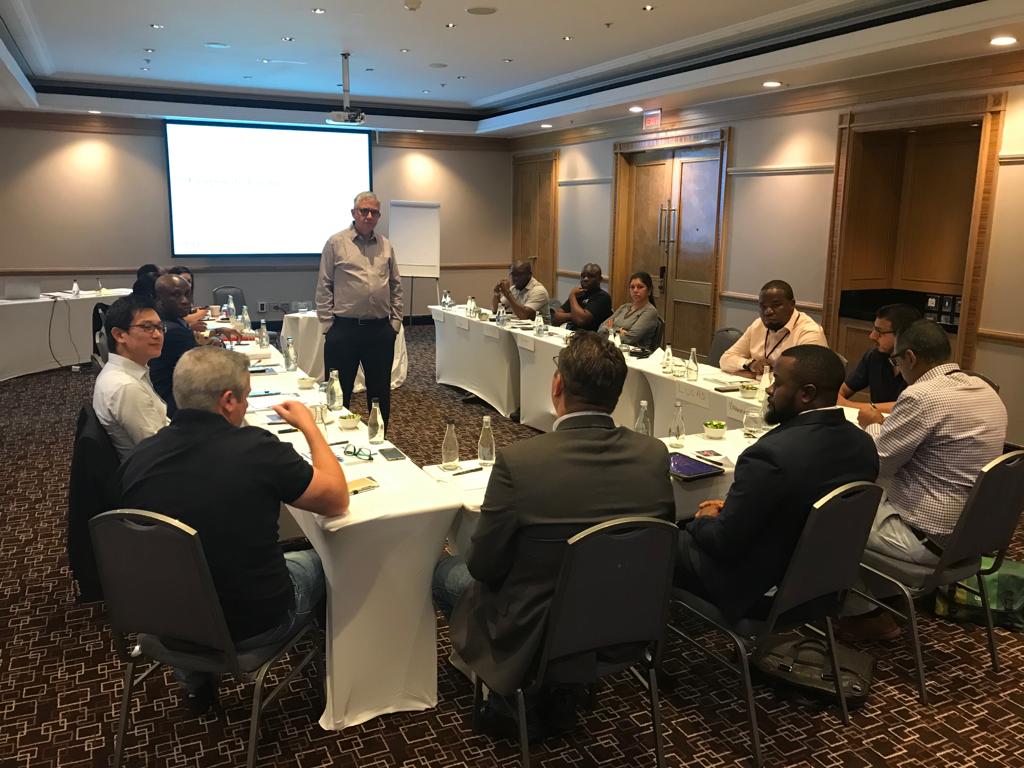
Register for One of Our GIS & Remote Sensing Courses
Build practical geospatial capability through our specialised GIS and remote sensing training programmes, led by experienced instructors across Johannesburg and major African hubs. Courses combine hands-on exercises with industry-standard software, real-world case studies, and applied fieldwork to turn geospatial data into actionable insight.
GIS & Remote Sensing Training Courses
What software do your GIS and remote sensing courses cover?
Our courses provide hands-on training in industry-standard software including QGIS, ArcGIS, ERDAS IMAGINE, Google Earth Engine, and Python for geospatial analysis.
Who are these courses designed for?
They’re designed for professionals, researchers, policymakers, and students across sectors like urban planning, agriculture, disaster management, public health, and natural resource management who need spatial analysis skills.
Do you offer training in drone and UAV mapping?
Yes — our Drones, UAV & LiDAR Mapping category covers drone mapping and surveying, LiDAR data processing and 3D terrain modelling, and drone-based multi-spectral imaging for precision agriculture.
Is AI and machine learning covered in your GIS training?
Yes — our GeoAI, Machine Learning & Big Data category covers geospatial machine learning, GeoAI applications in remote sensing, and big data analytics using Google Earth Engine
Do you offer courses focused on climate resilience and disaster risk?
Yes — including climate resilience and adaptation planning, disaster risk management, wildfire risk modelling, and geohazard mapping for landslides, earthquakes, and tsunamis.
Is there training specific to agriculture and food security?
Yes — our Agriculture, Food Security & Natural Resources category covers agricultural resource management, crop monitoring, soil health analysis, and smart farming GIS applications.
Do you cover urban planning and smart city applications?
Yes — including sustainable urban planning, smart cities development, 3D GIS and digital twin technology, and urban digital twin creation.
Is monitoring and evaluation (M&E) a specific focus area?
Yes — we offer a dedicated M&E category covering spatial data collection for M&E projects, satellite-based impact assessment, and geospatial data visualisation for M&E reporting.
Do you offer training in water and marine/coastal management?
Yes — including water resources management, blue carbon ecosystem monitoring, coastal and marine ecosystem monitoring, and shoreline change and sea-level rise analysis.
Where are these courses delivered?
We deliver training across South Africa (Pretoria, Cape Town, Johannesburg), Rwanda (Kigali), Zimbabwe (Victoria Falls), the UAE (Dubai), and Kenya (Nairobi), alongside broader delivery across our pan-African network.
How long do the courses run?
We offer both one-week and two-week training formats, with new intakes starting regularly throughout the year.
Can training be tailored to our organisation's specific geospatial needs?
Yes — get in touch with our team to arrange a custom date, venue, or tailored course content focused on your sector or application area.
How do I register for a course?
Browse our course categories to find the programme that fits your needs, then register through our course calendar, or contact our team for guidance on the right course for your organisation.